Rockhounding USA
: an informative and media-rich blog with articles, photos, videos, and maps to a wide variety of rock, mineral, fossil, and Indian artifact collecting sites across the USA.

Friday, April 14, 2017

Alabama Petrified Wood Adventure

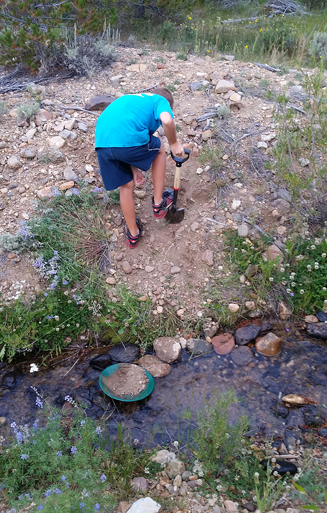
The Alabama air temperature may be acting like early summer in mid-April, but the chilly creek water is still acting more like the late winter. The shallow, gentle flows of the Uphapee (also known as the Chewacla Creek) in northern Macon County was the petrified wood destination for my son, Chase, and I. The sun was high in the sky, the temperature hovered in the mid-70s, and we brought sunscreen and high hopes to this fossil hotspot in the deep South.

After turning off Interstate 85 and heading north for about 500 yards, we pulled off on the east side of Alabama State Route 81 (just after crossing the bridge) and trudged along the bamboo-infested, sandy banks of the Uphapee. It was a bit of a challenge to find an easy way down to the water, but we forged our way across to the southern bank and then headed east along the sandy, gravel bars.

Our first thirty minutes of scouring the wide assortment of rounded rocks (many of them composed of thin layers that seem like petrified wood) yielded nothing conclusive. We pushed further east for about another 200 yards and I finally landed the largest single piece of petrified wood I have ever found.

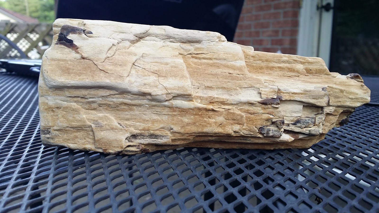
The 11-inch chunk was just a dark discoloration submerged about 6-inches deep along the bottom of the creek. I grabbed it and yanked it up, and let out a bit of a shout.

My son, not to be outdone, scoured the shallows only a few feet away and produced his own hand-sized chunk.

After another hour of fruitless searching, which included examining the gray clay layers on either bank, I headed back west about 50 yards and spotted a nice piece jutting up right at the southern edge of a gravel-bar island. The texture and detail of the jagged fragment was stunning.

I would have loved to have hunted on the shores on either side, but the density of the woods and the unmarked stretches of private property quickly squelched that enterprise. Since this trip, I have discovered that many people bring long metal poles and plunge them into the soft silt of the creek bottom. Large pieces of petrified wood are often found buried in the mud. Having collected petrified wood in Arizona and Colorado, I am used to finding large quantities of smaller chunks scattered over a wide area, but it is puzzling to me why we didn't find lots of smaller, rounded pieces on the gravel bars. We spent about three hours total, and I only found one small chunk that might be petrified wood (that wasn't down in the water). The reputation of the area as being rich in petrified wood led me to believe that we would readily find lots of smaller pieces scattered about. That just wasn't the case.

I've heard that there is more wood (and some of it coated with small crystals) to be found on the western bank of the creek leading up to the dam in Wetumpka, but that locale will have to wait for a future trip.

The creek had discolored the exterior of our fossils to a dark brown (almost black) along with a deep green, but we soaked them in a bucket of water mixed with healthy doses of C.L.R. cleaner (readily found at Wal-Mart) and they cleaned up nicely.


Click on this link for a Google Maps marker to this exact hunting spot:


Visit our Rockhounding USA Store. Find that perfect gift for any Rockhound or Prospector in your life!

Sunday, February 14, 2016

Indiana State Road 1: Not Fossil Rich...Fossil WEALTHY

With over 40 years of experience scratching the dirt, chipping the rocks, and flipping the stones, I can attest to the fact that the phrase "hunting for fossils" is quite correct.

Just as the big game hunter must wait patiently in the wild, or must cover a large territory, in search of their prey, a dedicated fossil hunter spends more time looking than finding.

But then there are those locales that defy description. These locales are so packed with remnants of past life that we get the extreme joy of actually rejecting "lesser quality" finds.

Like a gorgeous gal at a dance who can pick and choose her partners, these sites allow us to turn down anything below a certain expectation of quality.

The famous Indiana State Highway 1 roadcut a few miles north of St. Leon is one of those rare places. In over 4 decades of rockhounding, few sites that I have visited can even begin to compare with the sheer quantity and quality of fossil-easy-pickings here.

The terraced slopes gracing both east and west sides of the state route are nearly solid aquatic fossil beds. Almost every rock you can pick up, see, or touch is a mass of the memories of marine life.

I have visited the site on multiple occasions with my son, Chase, and the locale has never ceased to amaze me in terms of the richness of the material. There are signs warning over-zealous collectors against using large tools (prybars, etc) in the area.

But trust me, you wont need much more than a small hammer, chisel, and a large bucket or two.

My personal favorites in the area are the horn corals, but brachiopods, bryozoans, and even trilobites are found throughout (though a trilobite here is a rare gem).

In other collecting sites around the world, the fossil rich zone is usually a single, well-defined layer. But here, all the layers, from those even with the highway, all the way to the top of the deep roadcut, are packed with fossils.


To reach this ancient treasure chest, take Interstate 74 to the St. Leon turnoff, then head north. Once you pass through St. Leon, the huge roadcut (about 1/2 mile long!) will be approximately 3.3 miles north of town.


CLICK HERE for a Google Map to the exact location


A nice horn coral in matrix


Visit our Rockhounding USA Store. Find that perfect gift for any Rockhound or Prospector in your life!


Friday, February 12, 2016

Bountiful Bladed Blue Barite Bonanza!

Our August 2015 mineralogical expedition through the Rockies led us to a little gem (pun intended) just outside of Hartsel, Colorado. I had read about the famous and beautiful bladed blue barite found in the iron-rich clays of Park County, and my son Chase and I had to spend a few hours investigating.

The digging site is on private property, and one must first pay a small fee and obtain permission at the Bayou Salado Trading Post. This little shop is a rockhound's dream, with a rich collection of specimens from all over, including all of the famous local minerals (amazonite, smoky quartz, and aquamarine).

The distinct outline of Mount Antero hangs in the distance to the west as you enter the shop, where you will meet either Dave or Lark Harvey. They are wonderful folks and full of local information. After a brief meet and greet, we signed the release form, and they gave us directions to the claim.

After leaving the Bayou Salado Trading Post, we drove 1.33 miles west on Highway 24, until we arrived at a small dirt road and gate on the left (Cold Row Rd.). The collecting locale, located on the side of gentle hill, is approximately 1.4 miles down this lane (south).

There are a few gates that you must pass through, and it is important to close and latch the gate behind you at each of those important points.

A large exposed area of red clays is on your left, and the evidence of blue barite is abundant, with tiny, shiny pieces of the treasured, bladed crystal form littering the diggings.

There are a few more pits located off to the east and north, and these need to be explored as well. Bring a small shovel and a trowel and a bucket (and water).

The late summer breezes were a delight on a beautiful partly cloudy day, and we met a couple who had traveled from Washington state. They showed us their finds, which included some nice clusters with impressive color. They said that they had found them easily, without much effort, but away from the main diggings.

CLICK HERE for a link to the exact location in Google Maps


A nice golfball-sized specimen


Visit our Rockhounding USA Store. Find that perfect gift for any Rockhound or Prospector in your life!

Tuesday, February 9, 2016

Ruby Mountain Adventure

No Rubies, Topaz, or Garnets...but a fantastic time hiking with my son and collecting Apache Tears in Perlite during an August 2015 trip to Colorado.


A view from near the top, looking northwest 

The western slope (private property)


The trail-head on the eastern side


Visit our Rockhounding USA Store. Find that perfect gift for any Rockhound or Prospector in your life!

Monday, February 8, 2016

Fossil Collection Photo Album

CLICK HERE to see a small section of my fossil collection

Click LINK to see the photo album


Visit our Rockhounding USA Store. Find that perfect gift for any Rockhound or Prospector in your life!


Mineral Collection Photo Album

CLICK HERE for a small sample of my personal mineral collection.


Click LINK to view a portion of my collection


Visit our Rockhounding USA Store. Find that perfect gift for any Rockhound or Prospector in your life!

Wednesday, September 9, 2015

Finding CASH along Cache Creek near Granite, Colorado (Gold Panning)


I've been blessed to have had the opportunity to travel all across this incredible land. From one sea to the other shining sea, from the Gulf down under to near the Great White North over yonder. I've hiked among ancient glaciers and floated down majestic rivers. I've trod the barren deserts, and camped among the towering Redwoods. When it comes to American geography and American geology, I've seen an exposure or two or three.

But none of these experiences or vistas can compete with a gorgeous late summer day, nestled within the scenic ridges among the Colorado Rockies while panning for gold along a picturesque creek with my son. The Cache Creek panning area is not quite 3 miles off of US 24 (and the Arkansas River) in Granite, Colorado.

Turn west onto County Road 398 (behind the Sage Cafe) and drive approximately 2.05 miles until you come to a hard 90 degree left turn ("Power Line Road"---you can't miss the straight stretch of power lines) and you will see the Cache Creek sign. Take that left, and continue south for approximately .90 miles and you will see the Cache Creek camping area (no utilities) on the left.

Cache Creek is a tiny, tiny stream about 200-400 yards to the east of the campground. The scenery is amazing, the wildlife is amazing (we saw antelope grazing off to the west along "Power Line Road"), and the variety of quartz along the wide gravel beds around the creek is amazing as well.

The water is shallow, only inches deep, and is less than 2 feet wide at most points (at least during the late summer. Spring snow melt may change things considerably).


Earlier in the day we had stopped at the famous "The Rock Doc" along US 285 in Nathrop, Colorado (MAP). We purchased a gold pan (with riffles), sniffer, collection bottle, and cruised north for fame and treasure. Well, we had a famous time and I will always treasure the memories with my son. We spent the last few hours of usable daylight on the first day, then hit it hard starting about 8 A.M. the following morning. We wrapped around lunch, grabbed a couple of large burgers at the Sage Cafe and headed south.


The ease of access, the beauty of the environment, and the lack of dangerous/deep/rapid waters makes this site ideal for bringing the whole family. My son, 11 years-old at the time, had to be literally dragged away as we left. He wanted just one more shovel-full, one more pan, one more chance to "strike it rich."


Click on Map to enlarge


A little "color" from the first day
There is a considerable quantity of pyrite (fool's gold) flakes in the strata and the creek. Sorting the wheat from the chaff may require some extra work, but the joy is not in the dollar value, rather the experiences and the memories made.

CLICK HERE for the exact location of the Cache Creek Campground in Google Maps.


Visit our Rockhounding USA Store. Find that perfect gift for any Rockhound or Prospector in your life!